The Municipality maintains several outdoor recreation facilities including two parks, four trails and seven Interpretive Sites. The Municipality also jointly coordinates, with the Town of Shelburne, the Shelburne County Arena and Shelburne Regiona High School Community Use room.
Parks & Trails Brochure
View our Parks & Trails brochure to learn more about our trails, parks, interpretive sites and other amenities. Includes maps, pictures, descriptions and other useful information.
Outdoor Living Guide
View our Outdoor Active Living Guide to learn more about our walking & biking routes, active transportation tips and kayaking opportunities. Also, get the inside scoop on some of our hidden gems, including beaches and parks.
Outdoor Living Guide (1.34 MB)
Parks
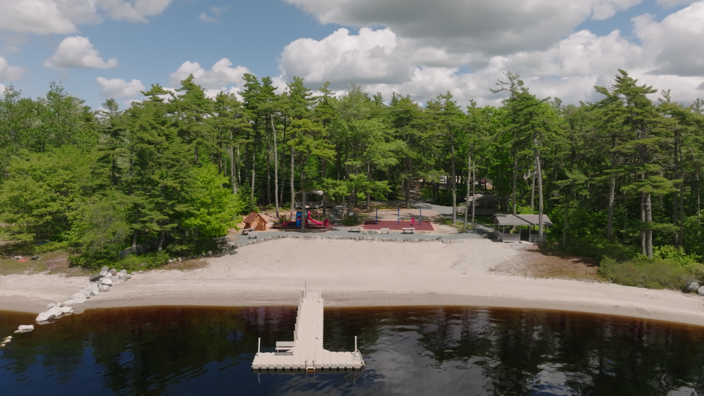
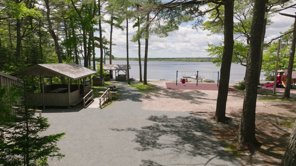
Welkum Park
Welkum Park, owned by the Municipality of Shelburne, is a small day-use park and beach located on the shores Welshtown Lake about 14km from downtown Shelburne. It offers many accessible amenities connected by a groomed pathway from the parking lot to the beach. Its features include play structures and natural playspace, picnic tables, gazebos, floating dock, change rooms, port-a-potties (seasonal), Mobi-Mat, playbin, sand beach, and unsupervised fresh water swimming. This hidden gem is a perfect spot for families and visitors of all ages to enjoy a refreshing swim in the calm freshwater, relax on the sandy shore, or share a picnic lunch under the summer sun.
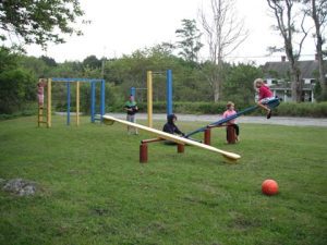
Jordan Youth Park
Located in Jordan Falls beside Highway 103, just before Exit 24, near the bridge that crosses the Jordan River. It includes climbing bars, teeter totters, a basketball hoop, several picnic tables and one enclosed picnic table area.
PUBLIC FEEDBACK-Jordan Youth Park (November 2025)
The Municipality is looking at doing upgrades to Jordan Youth Park. A concept for the upgrades has been developed, and we are seeking feedback from the public. Go go the following page to view the proposed upgrades and provide feedback. Jordan Youth Park Upgrades
Trails
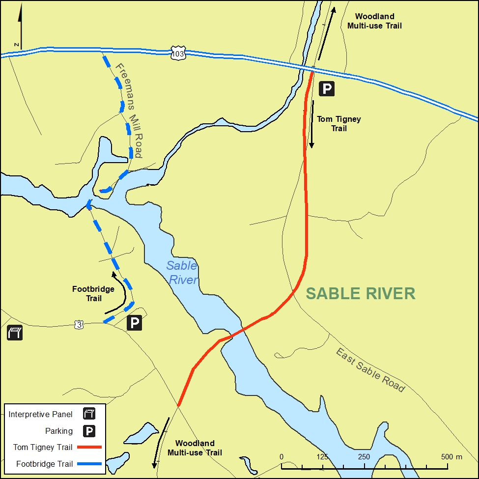
Tom Tigney Trail
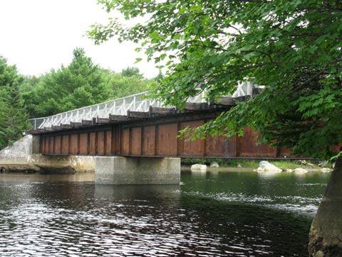
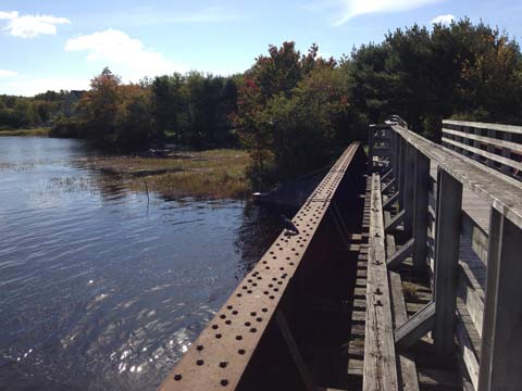
The Tom Tigney Trail (approx. 1.2 km) head is opposite the Chef’s Plate Restaurant beside the river and is a multi-use trail. A picnic table has been placed there for users to sit at and eat or take a rest to listen and watch the waters of the Tom Tigney River. The trail crosses the East Sable Road twice and about 3/4 of the way along it is a former CN bridge that now has a fenced board walk. On a warm, sunny day the view from the bridge up and down the Sable River is spectacular. This trail ends where the trail meets the old highway #3. Motorized use is allowed on the trail.
Check out the ATV Association of Nova Scotia Trail Etiquette Brochure for information on proper use of an ATV while out and about on the trails. ATVANS Trail Etiquette Brochure (875 KB)
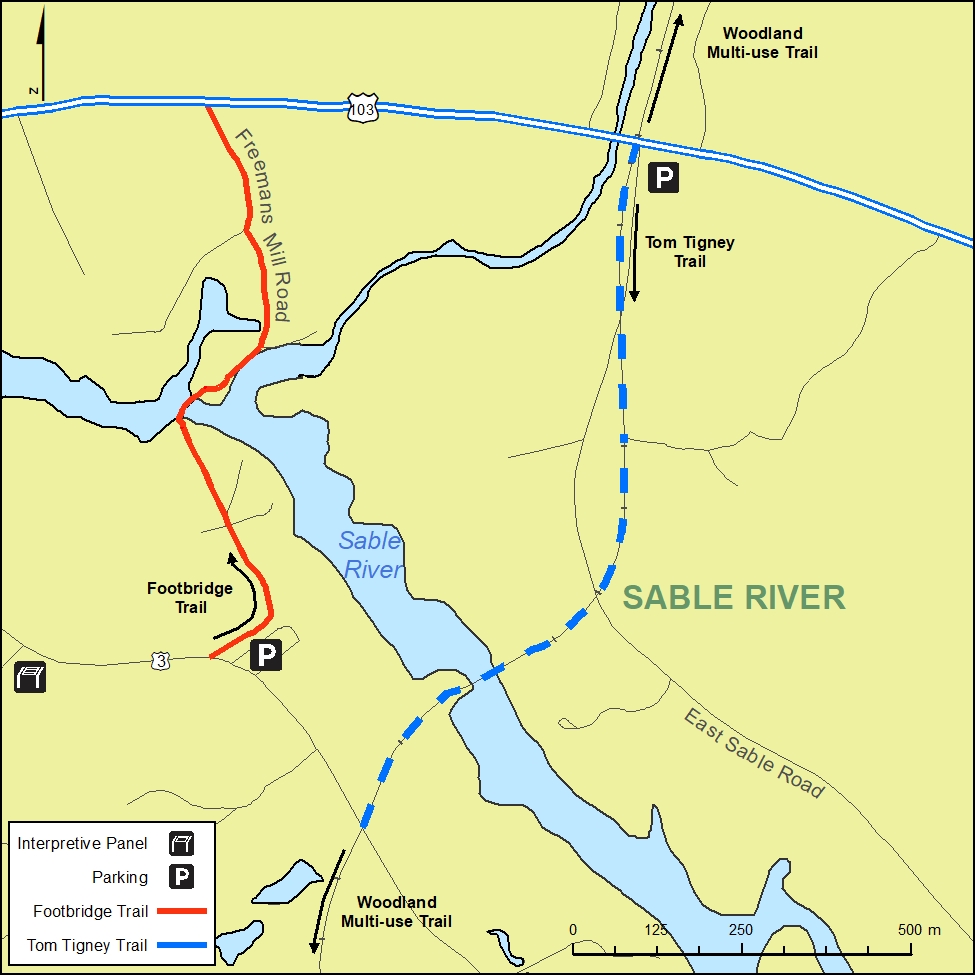
Footbridge Trail
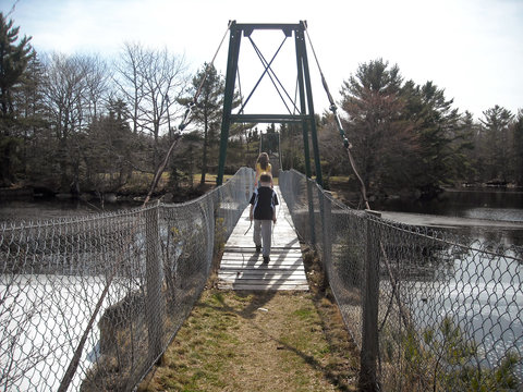
The Footbridge Trail (approx. 0.8 km) head is a small parking area located in the Sable River Volunteer Fire Department’s yard. From the trail head walkers follow the signs that lead them to the swinging bridge, across it, and along the Freeman’s Mill Road where it ends at Hwy 103. It is neat to experience the swinging movement under your feet as you cross the bridge. A major portion of the Foot Bridge trail has been used by the Sable River community for over a hundred years and is known locally as the “footpath”. Motorized use is not allowed along the Foot Bridge trail.
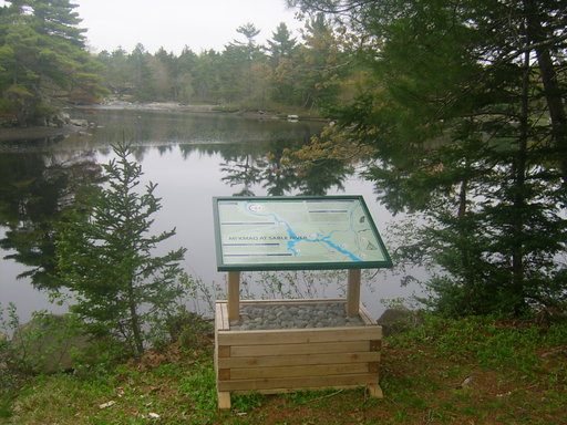
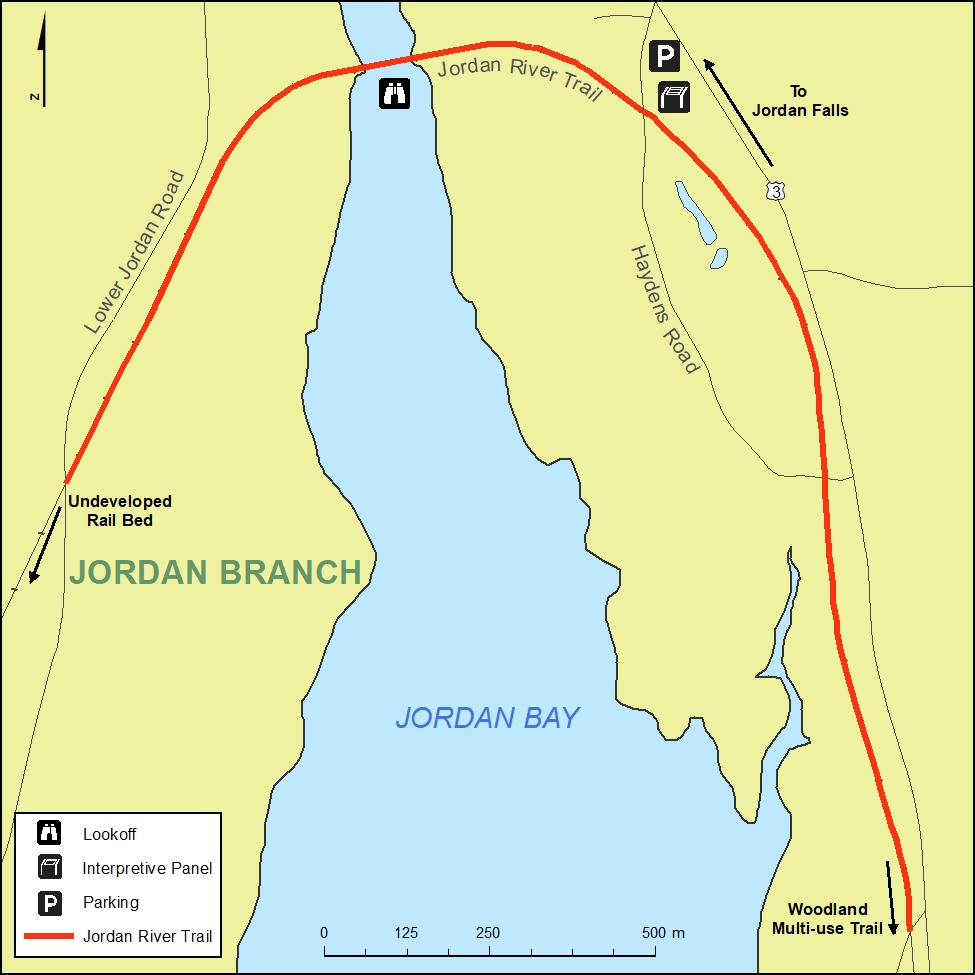
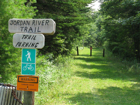
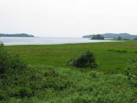
Jordan River Trail
The Jordan River Trail (approx. 2.6 km) is located in the Jordan Falls community. To get to the trail head from the 103 hwy take exit #24 along #3 hwy from Jordan Falls to Lockeport. Turn right onto Hayden’s Road. The Trail head is located in a small parking area beside Hayden’s Road. From the trail head you can walk along the trail to the left to end near Camp Jordan or to the right to go across the Jordan River. The former CN bridge has a fenced board walk along it, you walk beside salt water marshes to the trail end where it meets the Lower Jordan Road. Motorized use is allowed along the Jordan River Trail.
The Shelburne County arts Council commissioned Hayward Meisner of East Green Harbour to make wind chimes for their Outdoor Art Project. The wind chimes were installed at the bridge on the Jordan River Trail.
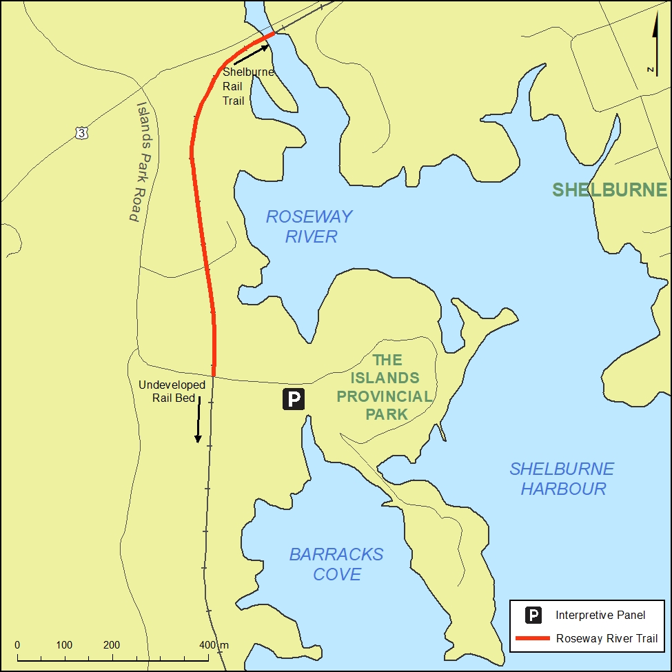
Roseway River Trail
The Roseway River Trail (approx. 1 km) begins at McGill Point Lane and crosses the Roseway River via two bridges. It follows the former railway bed and ends at the road near the entrance to the Islands Provincial Park. Motorized use is not allowed along the Roseway River Trail. The Roseway River Trail connects to the Town of Shelburne’s Rail Trail (3.5km) at McGill Point Lane.
Woodland Multi-Use Trail
The Woodland Multi-Use Trail is owned, operated and maintained by the Woodland Multi-Use Trail Assocation. The trail has been developed across many parts of Shelburne County. In the Municipality of Shelburne there are 10 Kms of the trail between Hwy 3 in Sable River to Canada Hill Road that connects with the Tom Tigney Trail (1.2 km Municipality of Shelburne trail) at one end and joins another 8.4 km trail from Hwy 103 in Sable River to the Queen’s County line at Wilkins Lake to join the Queen’s County trail system into Port Mouton and Summerville.
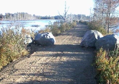
Trail Etiquette
- Respect the privacy of adjacent property owners by remaining on the trail at all times.
- Take only pictures and leave only footprints, so that others will be able to enjoy the same beauty.
- Garbage cans are located at the trail heads.
- Fires and camping are strictly prohibited.
- Remember the 3 C’s: Common Sense, Communication, and Courtesy.
- Children and pets should be kept near you at all times, as vehicle traffic may be present along or near the trails.
- All pets must be leashed. Please clean up after your pet.
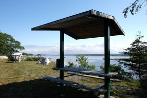
Interpretive Sites
There is an Interpretive Site located in each of our seven Districts. Five of the seven sites offer scenic Look Offs. Each Interpretive Site includes a safe, level, graveled area for parking, a covered picnic table, a waster separation station and interpretive signage to highlight the various points of interest.
Interpretive Sites Virtual Tour (12.24 MB)
Locations:
District #1 Clyde River – Civic #13 Quinns Road
District #2 Gunning Cove – Civic # 1623 Shore Road
District #3 Lower Sandy Point – Civic # 1584 Sandy Point Road
District #4 Upper Ohio – Civic #35 Doreys Bridge Road
District #5 Jordan Falls – Civic #146 Haydens Road
District #6 West Green Harbour – Civic #611 West Green Harbour Road
District #7 Sable River – Civic #140 Highway #3 Sable River
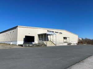
Shelburne County Arena
The Shelburne County Arena is owned and operated by the Shelburne County Arena Association. It receives operational support from the Municipality of Shelburne and Town of Shelburne. The Arena Association is governed by a board of directors that consists of community volunteers and Municipal and Town representatives.
The Shelburne County Arena is open from mid October to mid March each season.
For more information or to book ice times call the Arena Manager at 875-2977
Check out the Facebook page Shelburne County Arena
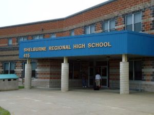
Shelburne Regional High School
Community Use of SRHS
Community use of SRHS is available to residents of the Municipality and Town of Shelburne through a signed Joint Use Agreement with the Tri-County School Board and the Department of Education. SRHS is a community school, which means it is open for use from the public after school hours. It has many spaces available for use and a variety of recreation, leisure, and special interest programs take place at the school throughout the year.
All rentals and programs are coordinated by the Benn Himmelman, Physical Activity and Community Use Coordinator, office located at SRHS. If you have any program ideas, would like to book a space at SRHS or want more information about programs call 875-2831 or email Benn.Himmelman@municipalityofshelburne.ca
Find us on FACEBOOK
Check our Facebook page “Keep It Moving” for updates and cancellations. Community Use is closed when there are school cancellations, due to weather. Programs can also be cancelled due to school basketball games and other events. All cancellations will be posted on the Facebook page.